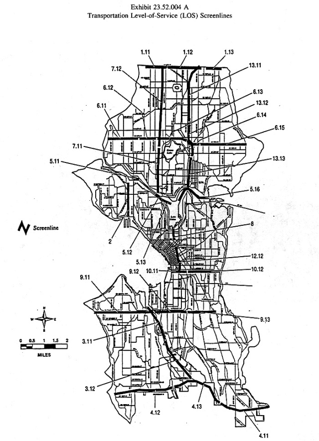
 Even though I have not fully addressed the issues I raised with the State Environmental Policy Act, I think I can cover the next chapter in the code. As I suggested SEPA has some thresholds that are set by local government. There is still some lack of clarity (even among people I asked) about whether parking and other traffic related issues are out of the SEPA process or not. But the code essentially mandates that if a project has an effect of the Level of Service (LOS) of roads then there has to be some mitigation.
Level of Service is measured using volume-to-capacity ratio or v/c. Volume to capacity is determined, essentially, by looking at how the increases in traffic compare to the ability of the existing right of way to handle additional traffic. I can’t fully explain what the ratio means qualitatively so I will let this chart from San Joaquin in California explain it for me:
This “grading” scheme is usually how I think of LOS being expressed, without the reference to a ratio. Essentially too much development leads to more traffic which creates congestion which creates “failure” of an intersection. I can think of plenty of intersections like this in town. You probably can as well. They are places where, for example, cars that have a green arrow can’t move because, even though they have the green, the intersection is full of cars.
There is an underlying philosophical or economic assumption behind LOS: congestion is bad and we don’t want it. So the code tries to establish a baseline measurement, determine what LOS means, and when new projects adversely affect LOS creating more congestion then those projects will have to figure out how to mitigate that impact.
Here’s the appendices A and B in this chapter that outline these measures:
I guess I don’t share the underlying philosophy of LOS which is that what we should be concerned about with new development is the affect of that development on the operating speeds of cars. How about we adopt a new philosophy and make the code speak to that new vision. Imagine if we followed my Transportation Priority Pyramid (TM):
The idea is that the further up the pyramid you go, the greater the LOS should be. If we measured projects this way imagine what things might look like. We’d have to develop a completely new measuring stick for LOS.
The folks at Walk Score might have some ideas. They already can give you a measure of how walkable your neighborhood or work place is. Now imagine if we mandated improvements of those base level measurements. Any new project has to improve the walk score of people within one mile.
What effect would this have on new development? What effect would this have of LOS for pedestrians? If we prioritized walking over driving and regulated for that, what would our city start to look like?


Love it. This is how I’d see the rating system applied to feet:
A Free flow of movement. No vehicles in path. No crosswalks required.
B Mostly unconstrained movement. Few vehicles in path. Crosswalk buttons immediately turn intersecting vehicle paths to yellow, then red.
C Somewhat constrained movement. Vehicles share path. Crosswalk buttons immediately turn intersecting vehicle paths to yellow, then red.
D Constrained movement. Pedestrians limited to sidewalks. Crosswalk buttons immediately turn intersecting vehicle paths to yellow, then red.
F Low priority pedestrian access. Pedestrians limited to sidewalks. Traffic lights give vehicles priority, and pedestrians must wait as long as a full cycle after button press.
N/C Pedestrian danger. No sidewalks. Path striped for vehicles only.
Of course almost all of North America’s pedestrian spaces would be rated as F or no credit.
Matt,
That is what I’m talking about. I need to connect you to the Walk Score folks.
I think a rating system like this — modeled on LOS, but applied to feet — would be illustrative of our priorities. It would take awhile for those to shift. But that’s the point. We have to start somewhere.
Pingback: Being a pedestrian is more dangerous than it should be | Seattle's Land Use Code
Pingback: Life on the run: new development and pedestrians | Seattle's Land Use Code
Walkscore only measures the availability of destinations. It does not account for whether or not there are pedestrian facilites. The best way to increase your walk score is to add a grocery store.
The Highway Capacity Manual, 2010 edition, includes a methodology for measuring pedestrial level-of-service. It is not based on capacity (most sidewalks have too few people, not too many) It is based on percieved safety. Their research points to these factors as the big drivers (pardon the pun) 1. is there a sidewalk, how far are the people away from the cars (lateral separation) and how fast are the cars going. Its a big fancy linear regression, but that’s the simple version. They also have a model for bicycles and transit level-of-service.